|
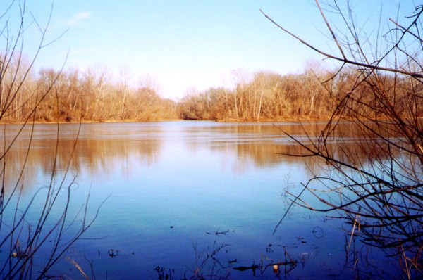
The
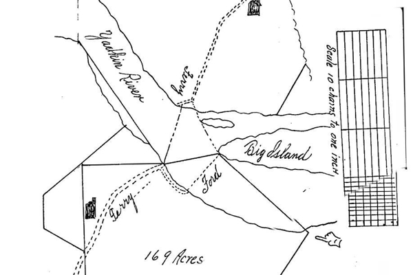
Yadkin Ford and Ferry crossed the Yadkin River at the upriver
(western) end of the Big Island, above the Island and Trading Fords.
These crossings were significant to transportation and settlement
history, and played a role in both the Revolutionary and Civil Wars.
The
Yadkin Ford was visited by Hugh McAden, an itinerant preacher, in
1755. Its beginning as a European settlement
crossing has probably been lost in Anson and Bladen county records,
which have been destroyed. There are numerous mentions of the ford
in old Rowan county records. The Rowan county court ordered a road
from Bethabara (the Moravian Old Town in present Winston-Salem) to
the Yadkin Ford in 1763. On the river's south side,
John Long Sr. had been appointed Commissioner of the road from
Salisbury to the Yadkin Ford in 1758. A ferry at the
location was mentioned in 1780, and John Long's
(Jr.) Ferry is found on an 1814 map. "John Long's Road"
became the foundation for our present Long Street through Salisbury
and Spencer and was referred to in a 1780 deed as "the Great
Road Leading from Salisbury to the Yadkin." Thomas Cowan and then John Hedrick later
ran this ferry.
Retreating
in the face of Cornwallis' occupation of Charlotte, General Jethro
Sumner took post at the Yadkin Ford from September 28, 1780 until
October 17, 1780, when he pursued the retreating Cornwallis. The
camps, Yadkin Ford on the north side of the river and McGoon's Creek
on the south, were active military outposts, and swelled with General
William Smallwood's and Daniel Morgan's troops. Southern Commander
General Horatio Gates ordered Gen. Sumner "you must on no
account abandon the defense of that ford."
During
the War between the States, the Confederate Camp Yadkin was fortified
on the hill north and west of the Yadkin Ford, primarily to guard the
new railroad bridge just above the Yadkin Ford. Gen. P.G.T.
Beauregard also ordered fortifications to guard all the nearby river
crossings. Two possible outworks have been identified near the
Yadkin Ford: one on the bank of the river beside the
railroad bridge, the other beside the Yadkin Ford road trace, running
parallel to the railroad tracks. One of the last staged battles of
the Civil War in North Carolina occurred here on April 12, 1865.
Confederate troops under Gen. Zebulon York held off a five and a half
hour artillery barrage by Col. John K. Miller's 3rd Brigade of Union
soldiers under Gen. George Stoneman. Stoneman's troops returned to
Salisbury without damaging the bridge.
By
the end of the eighteenth and throughout the nineteenth century, the
Yadkin Ford logically was used more than the two adjacent fords, as
it was most directly aligned between Salisbury and Lexington,
Guilford Courthouse/Greensboro, and the Moravian towns/Winston-Salem.
Despite the fact that the Beard bridge (in use 1818 - c. 1868)
upriver and the later Piedmont Toll Bridge (c. 1899-c. 1922) reduced
use of nearby fords and ferries, the Yadkin Ford and ferry continued
as a vital transportation route until the first free bridge (the
Wil-Cox Bridge) was built in the 1920s. There are indications a
later variant route of the Great [Wagon] Road passed over it. While
some deeds refer to "the Great Road from Salisbury to the
Trading Ford of the Yadkin River," others refer simply to the
"Great Road" or
the "Great Road Leading from Salisbury to the Yadkin." This may have reflected the road
having become a main road from Salisbury leading to both the Yadkin
and Trading Fords. Surely, thousands of our ancestors traversed the
Yadkin and Trading Fords, as they traveled south from Pennsylvania to
settle in Piedmont North Carolina and points farther south and west.
Roads
leading to the Yadkin Ford and Ferry on both sides of the river remain,
their locations almost exactly matching historic maps. Sadly, these will be
destroyed by NCDOT's realignment of I-85.
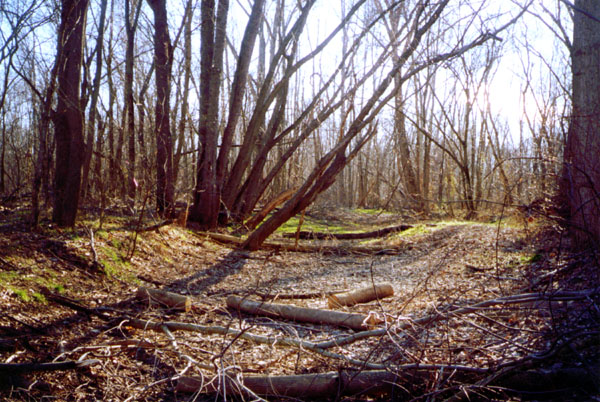
Road to the Yadkin Ferry (Rowan)
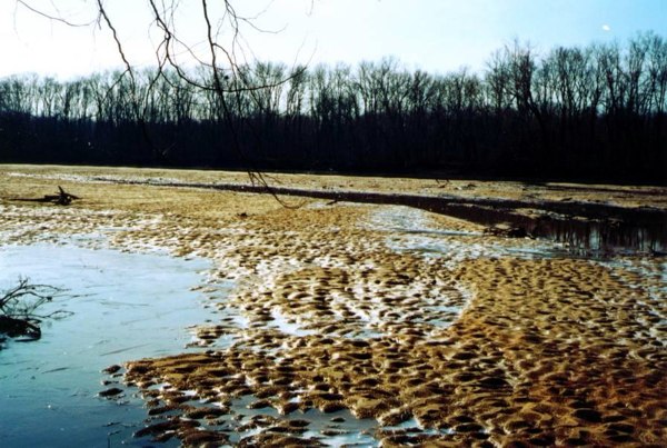
Sandbars on the Rowan side of the Yadkin Ford are frequently visible
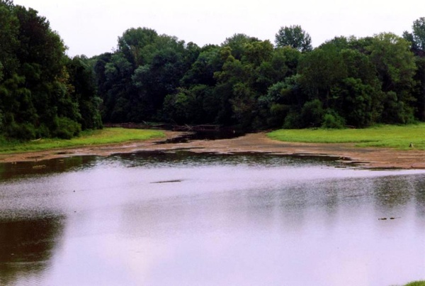
Davidson side of Yadkin Ford was visible in 2002
|